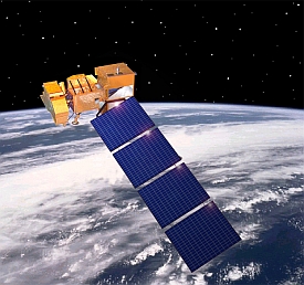
Researchers at Carnegie Mellon University in Pittsburgh developed a capability to assemble and view time-lapse images of earth collected from NASA Landsat satellites over the past 13 years. The team from CMU’s Robotics Institute, working with colleagues at Google and the U.S. Geological Survey, created this feature by extending GigaPan technology for capturing and assembling digital images into panoramas and later into videos.
Google is making available the new time-lapse feature as part of its Google Earth Engine that provides satellite imagery for economic and environmental analysis. In addition to providing time-lapse collections, visitors can zoom in or out on any spot on the globe and move back and forth in time. Applications of the technology include progressive visual depictions of urbanization, deforestation, changes in land-use patterns, and estimating agricultural acreage.
Google, NASA, and Carnegie Mellon previously collaborated to create GigaPan, a technology for capturing thousands of digital pictures and stitching those frames into panoramas that can be explored interactively. The GigaPan Time Machine is a product of GigaPan developed with Google’s support. That product takes advantage of the HTML5 language built into new versions of Web browsers, such as as Google Chrome, to extend GigaPan into video.
Randy Sargent, a systems scientist in the Robotics Institute and a visiting researcher at Google, along with CMU colleagues Paul Dille and Chris Bartley, developed algorithms and software architecture that make it possible for the GigaPan Time Machine to shift from one video portion to another as viewers zoom in and out. The time-lapse feature of Google’s Earth Engine combines the GigaPan Time Machine with the Earth Engine’s computational power and Landsat image archive to create zoomable videos accessible from a modern Web browser.
Sargent notes that the easier access to satellite imagery will help focus discussions about land use, climate change, and environmental policy. “You can continue to argue about why deforestation has happened,” says Sargent, “but you no longer will be able to argue whether it happened.”
Videos, such as the one below showing ways that the time-lapse tool can be used, can be viewed on the Earth Engine site.
- Industrial Robotics Software Repository Established
- Google Granted Patent for Autonomous Vehicle Technology
- Continuous Imaging Petri Dish Based on Smartphone Technology
- Software Developed to Generate Neural Brain Maps
* * *


 RSS - Posts
You must be logged in to post a comment.