28 September 2015. A San Francisco company that designs environmental sensors and networks is partnering with Google Maps to track air quality in three California regions. Aclima Inc. and Google Maps announced the partnership today at the annual meeting of the Clinton Global Initiative in New York, but no financial details were revealed.
Aclima Inc. develops sensor-based systems for measuring health and environmental air quality. The systems are designed to capture data from large numbers of air quality sensors inside buildings or for fine-grained local conditions in cities or regions. In addition, says Aclima, sensors can be deployed on vehicles running regular routes, such as buses or delivery vans, to capture air quality data in snapshots at various times of the day. The company then integrates the data collected in a cloud-based platform, with big-data analytical tools for users in business, public health, traffic management, and urban planning.
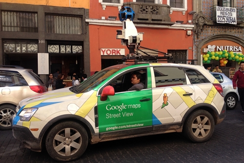
In July, Aclima and Google agreed to equip Google street view vehicles that photograph their surroundings as they travel over city streets and highways. Under that agreement, Aclima provided the Google vehicles with sensors measuring nitrogen dioxide, nitric oxide, ozone, carbon monoxide, carbon dioxide, methane, black carbon, particulate matter, and volatile organic compounds that can affect human health and climate change.
Aclima and Google Maps tested the systems with three vehicles in Denver and vicinity, gathering data from 150 million data points over 750 driving hours, and correlated the findings with stationary measurement sites run by Environmental Protection Agency. The company says its monitoring systems complement EPA’s measurements by providing more detailed knowledge of air quality at street level.
Under the new agreement, Aclima and Google Maps will apply the technology to street-level air quality measurements in Los Angeles, San Francisco, and California’s Central Valley, a primarily agricultural region, yet also the home of several cities, including the state capital Sacramento, as well as Fresno, Bakersfield, and Stockton. Aclima cites data and reports showing California with some of the most polluted air in the U.S., resulting in $1 billion in costs for asthma care, as well as 1 in 3 cases of childhood asthma.
Data collected in the project will be compiled and analyzed by Aclima, then made available through Google Earth Engine to EPA and Environmental Defense Fund, as well as researchers in general. Integration with Google Earth Engine is expected to make possible air quality maps overlaid on Google Earth and Google Maps.
Read more:
- Environmental Sensor Developer Reveals Collaborations
- Internet-of-Things Security Architecture Designed
- GE, Institute to Design Digital Manufacturing Platform
- Phillips, MIT Form Health Technology Collaboration
- New Company Founded to Develop Centimeter-Accurate GPS
* * *


 RSS - Posts
You must be logged in to post a comment.