


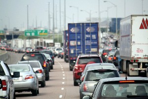
 Engineers at Massachusetts Institute of Technology and University of California at Berkeley devised a method for locating sources of urban traffic jams with anonymous data from cell phone records, which can encourage more effective strategies for reducing congestion. The team led by MIT civil and environmental engineering professor Marta González reported its findings in yesterday’s issue of the journal Scientific Reports.
This is the first large-scale study, say the researchers, to adapt data from cell phone billing records to urban traffic patterns. Previous studies of commuting relied on surveys or travel diaries that are prone to error because of the time lags or biases in self reporting. This study gathered data from the two metropolitan areas of their institutions — Boston and San Francisco — two cities with typical urban traffic jams, but different commuting patterns due to the local geography.
The MIT-Berkeley team analyzed three weeks of mobile phone billing records from 680,000 Boston-area residents and 360,000 San Francisco Bay region users. The researchers identified a driver’s home neighborhood from the regularity of the route traveled and from the locations of cell towers that handled calls made between 9:00 p.m. and 6:00 a.m.
To determine the neighborhoods as the largest sources of drivers on each road segment, the researchers combined the cell phone data with population densities and the location and capacity of roads in the networks of the two metropolitan areas. This analysis also enabled the team to identify the roads drivers take to connect from home to highways and other arteries.
The Berkeley researchers, led by engineering professor Alexandre Bayen, validated this approach with data from GPS sensors in San Francisco Bay area taxis. The GPS sensors compute the taxis’ speed based on travel time from one location to another, which can then determine congestion levels.
The results indicate small numbers of communities in each region supply a disproportionate number of commuters, and even small reductions in the numbers of rush hour trips from these communities could sharply cut traffic congestion. In contrast, most current traffic reduction strategies encourage all drivers to use alternative transportation or work from home to alleviate rush hour congestion.
The findings suggest canceling 1 percent of trips by select drivers in five Massachusetts towns would cut all drivers’ additional commuting time caused by traffic congestion in and around Boston by 18 percent. Likewise, reductions in the number of commutes from five San Francisco Bay Area communities would reduce overall travel times in that region by 14 percent.
Because the analytical method they developed uses only three sources of data — population density, topological information about a road network, and cell phone records — the researchers believe it can be applied to other urban regions. “In many cities in the developing world, traffic congestion is a major problem and travel surveys don’t exist,” says González. “So the detailed methodology we developed for using cell phone data to accurately characterize road network use could help traffic managers control congestion and allow planners to create road networks that fit a population’s needs.”
González and lead author Pu Wang, now a faculty member at Central South University in China, are now studying road use patterns in the Dominican Republic, France, Portugal, Rwanda, and Spain.
Read more:
- Method Devised to Improve Wireless Network Efficiency
- Public Domain Name Services Found Slowing Web Performance
- 120-Car Fleet Testing Intelligent Vehicle Network
- Traffic Intersection Study Pinpoints Stoplight Danger Zone
- Fuel Economy Standards Create Incentives for Larger Vehicles
Photo: Danielle Scott/Flickr
* * *
 RSS - Posts
You must be logged in to post a comment.